The area CUCC calls The Plateau is situated north of the Bräuning wall. To the west it drops off into Grüne Bichl, a large valley (relatively unvisited) which marks one boundary with the adjacent 1626 kataster area. To the north it continues further than most are prepared to walk over the rough limestone. Work done beyond CUCC's normal limit is considered under "Further" plateau and out to Augst-Eck. North of this is also area 1626. To the east, the plateau starts to rise towards the long Schwarzmooskogel ridge, and we take the break of slope as a rather arbitrary boundary with the western slopes of the next area, the Schwarzmooskogel ridge.
The route to the plateau takes between 25 and 45 minutes, depending on weather, load and fitness. This is to reach the start of the karren at the Schwarzmoosattel; it can take another hour or more to reach a particular cave.
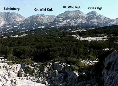
From the Schwarzmoossattel at 1684m, the plateau stretches out to the north, looking relatively level. On the map it appears gently undulating, rising from steeper slopes above Grüne Bichl to the west, levelling off about 1600m, and reaching 1700m in the east where slopes rise to the Schwarzmooskogel ridge. Far to the north, the bare limestone peaks of Schönberg, Große and Kleine Wild Kogel and Grieß Kogel rise to over 2000m.
Once down onto the plateau, the reality is a little different, as small-scale relief is made up of pavements and cliffs of up to 10m. One bit looks very much like another and an intermittent covering of impenetrable thickets of dwarf pine (known as Pinus mugo to botanists, Lärchen to the Austrians, and, for historical reasons, 'Bunde' within CUCC) also help to make progress and navigation very difficult. Sharp rocks and open shafts lie everywhere, awaiting the unwary.
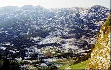
Small scars and dwarf pine dominate the foreground of this view to the Bräuning wall from the plateau below Top Camp.
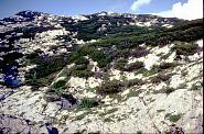
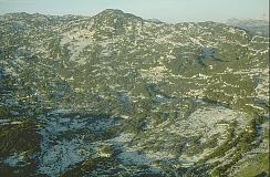
View over eastern edge of plateau to entrance 1623/82 and Hinterer Schwarzmooskogel beyond.
Potential new caves are frequent, although the plateau is characterised by snow- and scree-choked open shafts. Prospecting is time-consuming, and it's worth looking very carefully for a painted number or other signs of previous exploration (eg. bolts) before entering.
There has been a very significant number of recorded finds on the plateau, since the earliest years of CUCC's work.