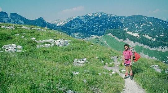
From the Loser Panoramastraße Bergrestaurant car park, take the path leading from the NE corner, which is slightly shorter, and soon joins the main path (numbered 201, and marked with red and white paint at frequent intervals).
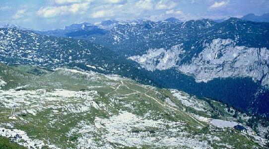
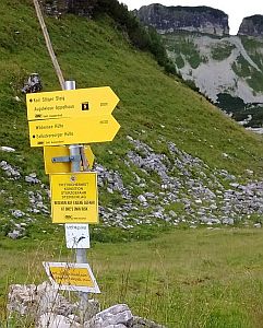
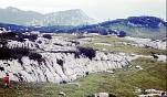
Following this gently undulating path for ten to fifteen minutes leads to Egglgrube. Ahead and to the right is a 10m cliff rising from the pasture to an area of karren and dwarf pine. To the left is a valley containing several obvious sinkholes, with a junction path signposted "Bräuning Zinken" (Weg Nr. 257) leading to Bräuning Alm.
 |
 |
 |
| Path 201 approaching Egglgrube | Signpost at junction | Valley to Bräuning Alm |
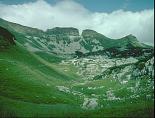
Take this left turn, up the west side of the grassy valley to a collection of six huts (seven from 1995) on level pasture near a number of small springs. The route to Bräuning Zinken passes these huts to reach the col to the left of the biggest peak - however this area is of little speleological interest. Our path crosses to east side of the valley and continues past a small limestone scarp on the right.
 | 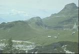 |
| Bräuning Alm | |
Above this scarp is another flat area of pasture, the site of CUCC's advance camp of 1977. The path also climbs this scarp a little further on, turning right (not very obvious) out of the continuing main valley. If the valley is followed up (this was our normal route in 1976 and 1977), the same destination can eventually be reached by a slightly rougher walk, as the path fades out in limestone pavement.
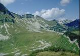 |  |
| Schwarzmoossattel approach | |
The main path leads to short climbs up and breaks out onto a ridge between the above-mentioned valley and the much deeper Kratzer valley, access to which is difficult at this point owing to steep limestone scars. Continuing, the path converges with the 1976 route coming in from the left at a small col, then contours below the small peak of Bräuning Nase to the left. Ahead is the site of CUCC's bivouac of 1979, and, slightly beyond, the broad col of Schwarzmoossattel.
The plateau lies directly ahead over this col, and may be reached by any of several routes through dwarf pine, with various amounts of scrambling. The whole area is pathless and very rough, though a few routes are marked by hunters with sporadic cairns. In recent years we have cairned a route (it is not a path) from just below the col (via a hidden climb down) to the Steinbrücken top camp bivvy. Every year we repair the cairns and place reflectors on them just for the period that expo is running.
Following the path round to the left (WNW) soon leads to a big cairn and a short scramble down to the old Top Camp, which has been used by CUCC between 1988 and 2000. This is adjacent to the only reliable water supply we have found, situated below the dramatic Bräuning wall. Please take care not to pollute the spring! Note that this camp site is still within the area designated as a "Naturschutzgebiet" (Nature Reserve) and permission is required to camp there.
The path continues below the Bräuning wall to the west, eventually to reach the inaccessible pasture of Gschwandt Alm north of Loser.
Turning right off the path shortly before old top camp cairned routes across the plateau lead eventually to the 76 bivouac location and then the Stone Bridge (Steinbrücken).