surface - LASER RANGEFINDER
Mike M.
Surface time 11 hrs.
Having got back from previous trip ~ 2 am then writing up findings, I [who?? MM from the comment about knees.] then discovered note on my tent that the others had volunteered me to go with the Austrians to show them our caves (at 9 am):-
Having warned them of my dicky knees he said the walk was easy and not far, so 1 hour later I was hacking up to the peak between V & H Schwarzmooskogel. The others went up to Hinterschwarzmooskogel to the fixed measuring point. Using very flash LASER RANGEFINDER, a permanent station (0/1) was made which gave a view of the plateau. The others moved their equipment to the above point and we went in search of Steinschlagschaft ? We couldn't find it ! Hence left a permanent marker (0/2) on a pavement of rock near one of our cairns and two deep shafts. See over for how to find this point.
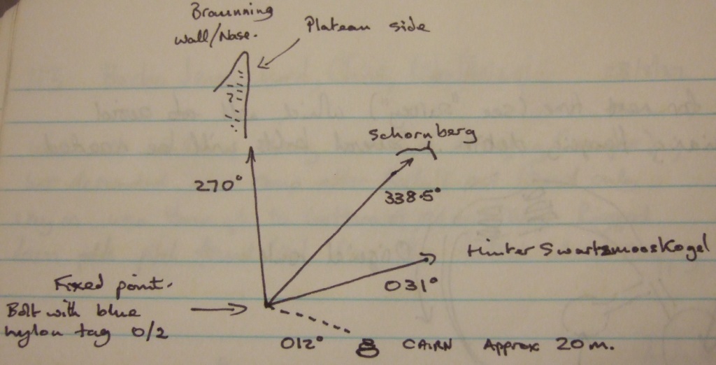
[ diagram which shows not how to find it, but how to know when you have found it ]
Then proceeded to make another mark on prominent outcrop of rock near large depression with snow plug and a number of deep shafts. (slightly (~10m) above path marked with cairns).
0/4 is the first survey point of Wolfhöhle. Then off into the plateau. Found 107, 83. If you follow gully up until you can see the peak between V & H Schwarzmooskogel, 0/5 is on a slab of rock above a gully to right. The edge of the gully also has a red paint marker !
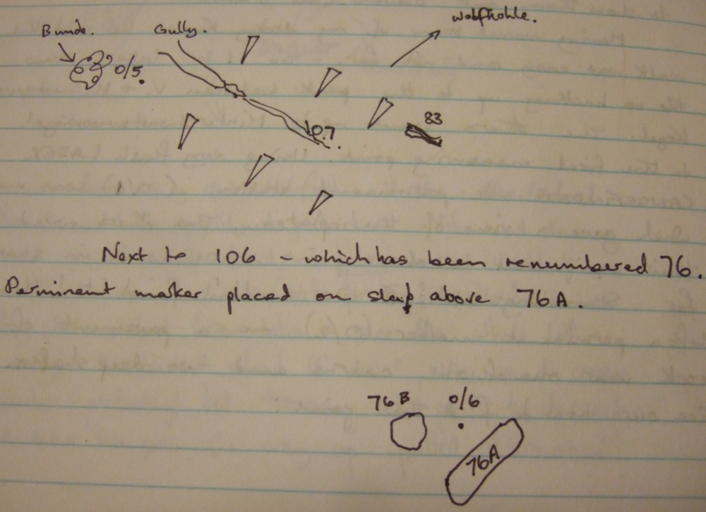
Next to 106, which has been renumbered 76. Permanent marker placed on slab above 76A.
The Austrians have reallocated 88 to the Germans who have an extensive cave of over 6 km with several pitches which drops into one of our caves. They don't know which one - we shall have to visit them to discuss.