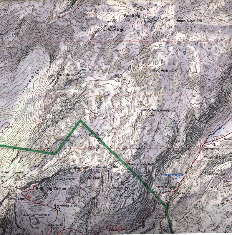
Exploration in the last few years of the last century showed that though a variety of different approach walks are needed to visit various parts of the long ridge on the SE side of area 1623, many of the significant caves form part of a single, very extensive, system.
In the southern part, the Vorderer Schwarzmooskogel (1843m), the area is bounded on the west by steep scars into the Kratzer valley and to the south and southeast by the cliffs of Weiße Wand, below which lies Altausseer See and the Hoch Klapf valley to its NE.
The ridge runs NNE, with a col at 1755m, before rising to the Hinterer Schwarzmooskogel at 1906m. To the west of this, the area slopes down to the bare karren of the plateau. Steeper slopes to the east drop into the Hoch Klapf valley which marks the boundary with the adjacent kataster region 1624. There is no real boundary to the north or northeast - just a limit to how far we have yet looked. Currently this is some distance further NE beyond the summit of the Nieder Augst-Eck. Beyond this, they fall into the remote plateau or Wildensee areas, as listed here.
The area is more densely covered with dwarf mountain pine than the plateau or other minor areas we have looked at, with a few "real" trees dotted about too. This tends to restrict prospecting to narrow corridors of access on established routes (these can hardly be described as paths).
Five approaches are in use:
