Surveys and Rigging Guides
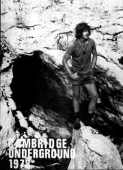
Cambridge Underground 1978, facing p 32There is also an area plan showing 82 in context with 145 and 148.
Underground Description
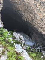
Very obvious walking sized cave entrance leads to a boulder strewn passage (ice formations early in season) into an aven with daylight entering 20m above. A scramble over boulders leads to Apfelschacht - a 6m pitch with loose boulders at the head. This drops to a 3m climb and then a 20m pitch Orangenschacht with a trickle of water entering halfway down. From the foot, a fine keyhole passage imaginatively named Schlüssellochgang, and a choice of routes. The most obvious way on is a 10m pitch, Bierschacht over a stalagmite flow to an awkward crawl, Worm Passage, which looked likely to end things. However, this opens out suddenly at a pitch head. Nocheinbierschacht is 15m, impressively free. At the foot, a vocal connection can be made with a phreatic passage above the third pitch which ends in a big hole.Ahead is a phreatic tunnel which chokes, and a large black emptiness. This is descended for 25m in four 6m steps, Viermalbierschacht, to a ledge big enough for one and a bit people. The stream goes over this ledge into a large black void. This pitch, Besoffene, is 50m and hangs free for all but the last 8m in a very impressive shaft. From the foot, traverse above a steeply dropping stream canyon to a sloping platform from which a 17m pitch reaches the stream floor. This cascades over a further 6m pitch, below which a climb out of the stream reaches a rig point for a 30m pitch ending on a slope down to a sump at -216m.
Explorers
CUCC 1977 - Team GeriatricWallets: scanned survey notes
There are 3 wallets with data for this cave:2007#96 2012#48 2015#65


