plateau - Top Camp - Surface Prospecting - Old & New Caves - 8.5 hours
Natalie Uomini

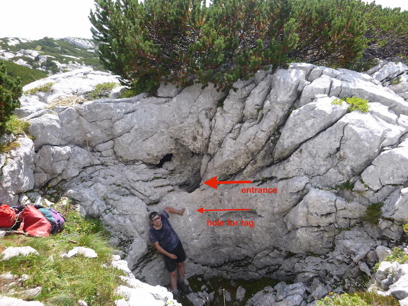
New cave 2018-NTU-01
Paul had prepared a list of some caves found in 2004 which were within 300m of Top Camp.
In the blazing heat of morning, Nat and Paul set off with packs full of SRT kits,
50m rope, hangers, drill, bolting kit, oversuits, helmets and lights.
First we went the wrong way and ended up meandering through bunda above top camp.
Finally we set a bearing towards one of the caves in question, and this took us on
a scramble parallel to (east of, uphill from) the path to Tunnocks.
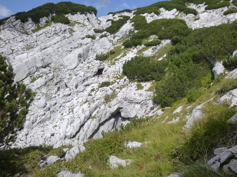
We bumbled onto a small cave entrance which we named 2018-NTU-01 located in a
gully filled with wild chives.
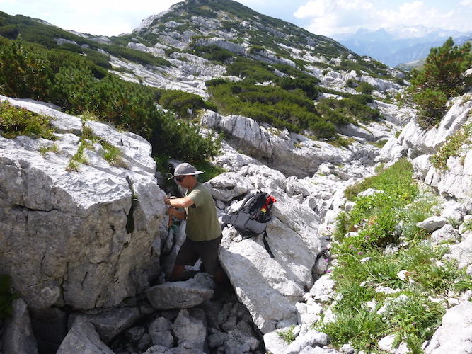
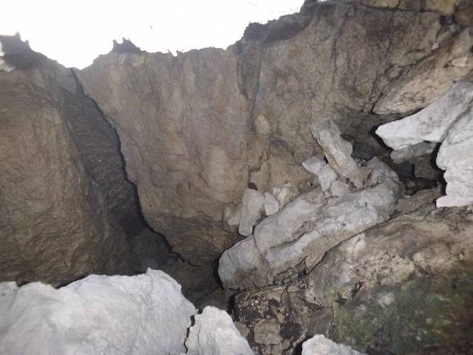
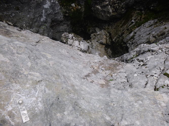
No noticeable draft, but it was hard to get my head right in. The shaft is definitely big enough for a person to stand in comfortably. With a bit of tidying up the big loose boulders inside the entrance, one could get into the shaft and see where the rift goes.
Data from Nat's GPS (Garmin Oregon 650):
1834m, N47°41.518, E13°49.298
UTM UPS: 33T 0411579, 5282737
GPS accuracy not noted for this point, but the other points this day had 3m accuracy.
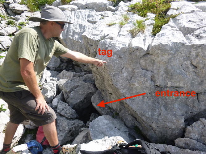
This cave was tagged by Nat & Neil a few days later on Aug. 13.
To reach this cave easily from Top Camp, just follow the Tunnocks path until
the cave marked on GPS as "1623.p2001-02", then turn right (uphill) and go up
a small chive & boulder-filled gully until you see the big boulder with the tag on it.
Rift hole to descend
Several meters downhill from 2018-NTU-01, in passing we waypointed on the
GPS a "rift hole to descend", which looked like a promising hole that is
nowhere near any already-catalogued waypoints.
1846m, UTM: 33T 0411511, 5282847. (no photo)
We finally rejoined the path to Tunnocks (which we should have used
all along) and after a while, we waypointed on the GPS another hole
that's most likely the same as catalogued 1623.p2002-07.
2018-PF-01,02,03
2018-PF-01 Tag: 1857m, UTM: 33T 0411526, 5282885
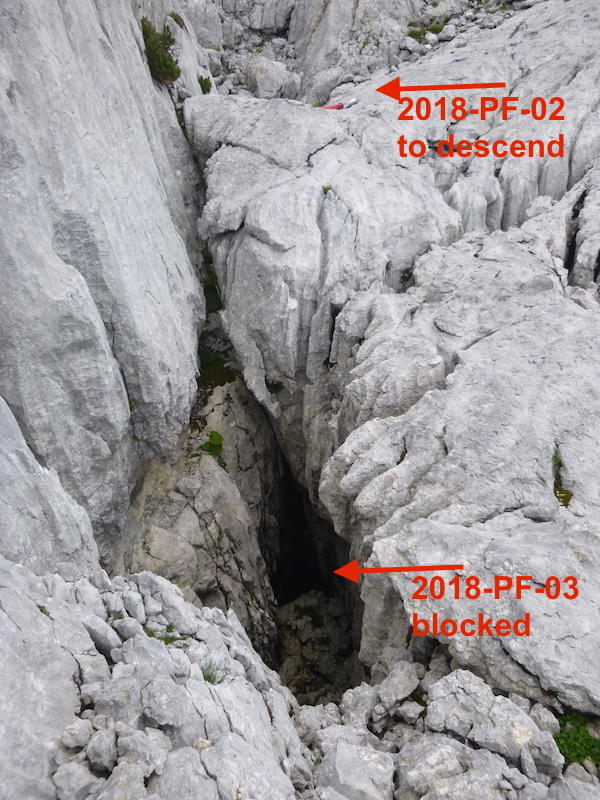
2018-PF-02: 1859m, UTM: 33T 0411540, 5282900
2018-PF-03: 1858m, UTM: 33T 0411530, 5282893
GPS with 3m accuracy for all.
2018-PF-01 is a 2m-diameter shaft with an easy climb down
to a mossy slope. We surveyed it [see Paul's excellent digital
survey].
2018-PF-02 is an impressive, open surface shaft about 3.5m diameter and 11.5m deep (as measured by Disto). It looks like it continues horizontally into a rift heading upslope. There is a good spot to drill bolts for rigging where we installed the tag.
2018-PF-03 is an open rift between PF-01 and PF-02 about 5.6m deep, 1.75m wide, 4.6m long (as measured by Disto). Paul climbed down PF-03 and found it was choked at the end nearest (heading towards) the big shaft PF-02. Thus, it dashed all our hopes of finding a free-climbable access to the big shaft.
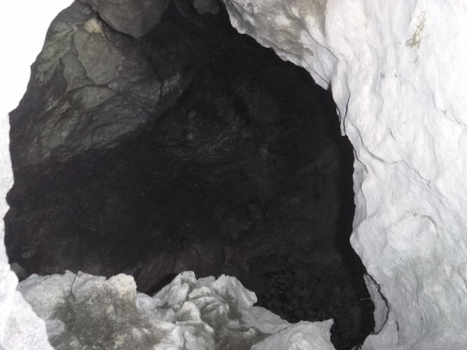
2018-NTU-02
Afterwards we circled painfully through obstacles of
larch and cliffs until we stumbled across another interesting
hole, which we named 2018-NTU-02.
1861m, UTM: 33T 0411522, 5282905, GPS with 3m accuracy.
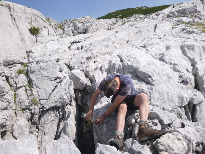
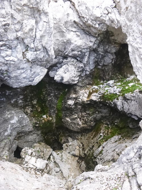
It is a window in the side of a surface shaft filled with
grass. Nat climbed down into it using a handline tied with
loops, which proved essential.
A big opening in the side of the mountain
Next we headed again for the mythical 2004-18, and reached the south-eastern edge of a huge steep-sided valley: Cubic Valley.
(Note: the next day we found a much easier way with Wookey, by going from the Tunnocks path round the northern edge of the valley, as recorded in our uploaded GPS track and described in the updated Approach to 2004-18.) Following the southern edge of the cliff, we found a way to climb down into the valley. From the eastern edge of this valley is visible a large opening in the opposite (north side) cliff, which I waypointed from my position. The opening should be investigated, as it seems to be below Tunnocks.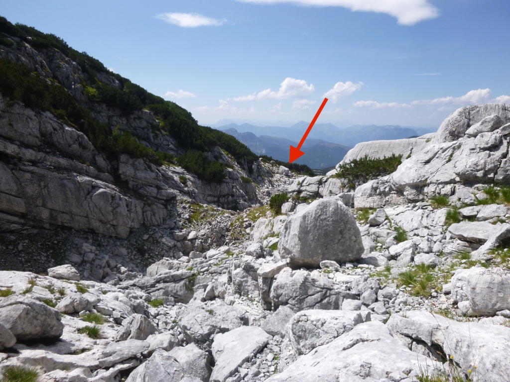
Freezer Hole
In the lowest point of the eastern bowl of Cubic Valley is a small
hole in the rubble which emits freezing cold air.
We measured the temperature just inside the hole as 9°C,
compared to 18°C just outside the hole (in the shade)
(- and the temperature in the sun on the plateau that day
was about 30°C). This hole is choked with rubble, but it would
certainly be an interesting digging project for future Expos.
2004-18 and Mystery Shafts
 ,
,
Finally, heading westward down Cubic Valley towards the Cube-Shaped Boulder, we reached the fabled cave. The whole section of valley is full of tantalising deep shafts which must be explored! Just beside 2004-18 we found another shaft with a tag marked "AA 1 2017" but there is no recorded survey, no database entry, no information anywhere about it .
[Ed. This is presumably Adam Aldridge who lost all his notes of a prospecting trip on 7th Aug.2017 (which was nowhere near here: see 2017-AMS-01) and tagged this on another prospecting trip before the 7th. and lost all those notes too.]
Beside this shaft is another shaft with a snow plug and 2 spits well positioned for rigging, but no visible tag nor informations recorded.
Who could have been there? [Ed. Adam A., clearly. See comment above.]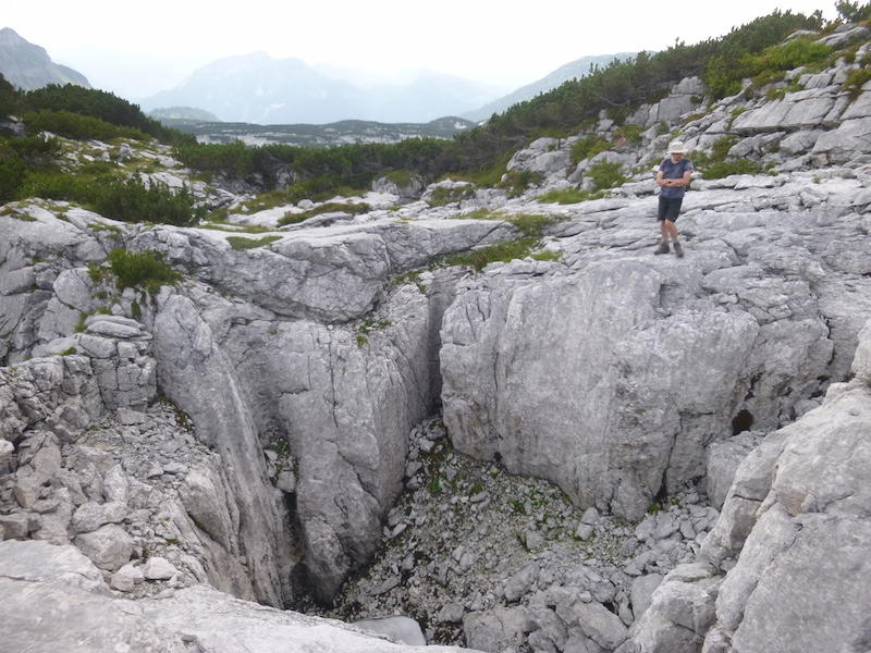
2004-16 and 2004-17 and Maybe Hole
As it was getting late and our water bottles were empty and
it was very hot, we left our heavy caving gear in a hole and
tried to head back to top camp. On the way out of the valley
we found the other 2 caves 2004-16 and 2004-17, which we
waypointed on the GPS (1878m, N47° 41.594' E13° 49.150' and
1881m, N47° 41.608' E13° 49.150', respectively).
Then we struggled on through thick larch and sheer cliffs,
passing by a potential hole to explore (UTM: 33T 0411410,
5282786), in our dehydrated and grumpy state, until we saw someone
walking on the Fischgesicht path in the distance, which we could
eventually reach and thankfully followed back to Top Camp, arriving
just 20 minutes before our callout time!