
a bit of the plateau
a bit of the plateau
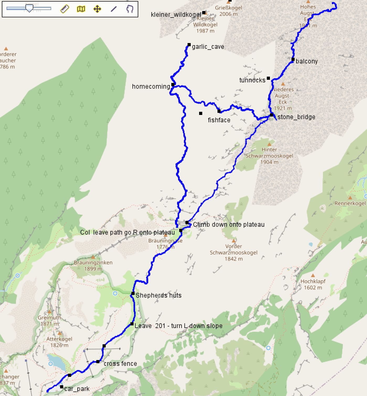
SAFETY. Everyone gets lost on the plateau.
Don't get lost for long as this causes rescue plans to be initiated.
Don't be misled by the apparent simplicity of the tracks. The plateau is very broken and is an unremitting extent of cliffs, holes and impassable dwarf-larch scrub ("bunde" as it is known on expo). You can be 5m from the route and have lost it entirely. The walk to and from the col leading to the plateau is comparatively easy as it is an obvious path, and is marked and signposted in the earlier section.
Android: Long press download this GPX file
iPhone Long press download this GPX file
If the quick start doesn't work for you, go to the general instructions further down this page.
When using your phone for prospecting for new caves, or refinding old entrances, there are two further useful files that you should consider downloading:
The map should now show a transparency slider which will fade the satellite image in and out. This will only work in online mode until such time as somebody works out how to cache the tiles (to be continued...)
It helps a great deal to get the contours and hill-shading but this is not free with iPhone or Google Play Store downloads of OSMand. However if you install OSMand from F-droid (Android only) instead, you can get excellently detailed contour maps for free. Or you can just pay €2.99 a month for OsmAndPro which is probably the only way to do it on an iPhone.
If using OsmAnd, you need to go to Plugins and enable "Trip recording" to be able to record track logs.
If you are looking for how to upload one of your own GPS tracks, go to gpxupload.
On Android, the way to start recording a track is to use the menu button in the bottom left and select "Trip Recording". On an iPhone there is a specific button which just records a track on the top-right of the screen.
The OsmAnd documentation says:
More documentation on this to follow...
Install a GPS app (e.g. OSMand) first.
Do one of
or, if you can't get those to work
| GPX format | KML format | ZIP of both |
|---|---|---|
| essentials2024 | essentials2024.kml | essentials2024.zip |
| entrances2024 | - | - |
| kataster-boundaries-as-tracks | - | - |
| essentials (downloads as XML) | essentials.kml | essentials.zip |
BEFORE you download the gpx file, install OSMand on your phone. Then, when the download happens, you will be prompted as to which app you want to use to veiw the file and you can select OSMand - but only if you installed OSMand first.
Use the links in the table at the top of the page.
This is easy on a laptop, but phone browsers make it difficult to download a simple link like that - just clicking will usually (unhelpfully) display it in the browser.
You need to long-click and pick 'download file' or 'download link' (chrome). Then either:
This is where it gets tricky because every device and phone app does this differently.
This should work the same way whether you have an iPhone or an Android phone.
We recommended OsmAnd as it is very capable, but you can use others.
On android phones, this may be best achieved by installing from F-Droid rather than the plan store
If you have a GPS-specific device such as a Fitbit, Apple watch, Garmin watch or other Garmin device, see GPS-devices.
This (nerds only) has been moved to a separate page: regenerating essentials.gpx.