Underground Description
Originally thought to be a choked shaft, it was noted as "worth another look" in 1987, but was not relocated in 1988. Closer inspection with a ladder revealed parallel slots in the rift and a noticeable draught.
The original entrance is a "walk-in" open shaft which leads on to a twisted vertical pitch of 17m, Parthos, into a sizeable chamber at the top of a rubble slope. The obvious small wriggle at the bottom of the slope leads to the Musketeers' Series, while a bolted climb leads to the main way on.
The Musketeers' Series consists of stooping phreatic passages, with a 5m pitch, then a couple of climbs to the head of an 11m pitch, Aramis, into a chamber. At the far end, a further pitch, Athos, is 8m. The way on is up a short climb to the head of a 5m+10m ramp, Porthos, down to a phreatic tube with a silted up floor. Digging in the silt revealed a tight rift rising up, but as this was too tight, the dig was abandoned. The water from Aramis descends a tight rift in the base of the phreatic tube, but after 3m, this too became too tight.
The climb up before the Musketeers' Series leads quickly to a T-junction. To the right, a winding ramp passage of decreasing size leads on and up with several fallen blocks making progress awkward. This route ends at a small chamber with an inlet dropping from the roof. Left from the T-junction leads on down a gently sloping boulder ramp in stooping, then walking passage. This increases in size and becomes steeper before emerging into the side of an enormous boulder ramp, Hillsborough Revisited. The inlet passage enters three quarters of the way up Hillsborough, which is 10m wide by 5m high and drops a total of 40m at 40°. At the base of Hillsborough, an aven rises to the surface and daylight can be seen reflecting off the sides of this second entrance. A third entrance was discovered on the surface which leads down a deep grike through a tight arch and into a small chamber. Digging boulders revealed a steeply inclined squeeze leading onto a pitch at the top of the Hillsborough ramp. The base of this pitch leads onto an inclined overhanging terrace with a hole at the back which drops 2m onto another inclined overhanging terrace. A 4m climb down from this ledge ends at the top of the boulder ramp of Hillsborough.
The base of Hillsborough was blind until a dig in unstable boulders on the left hand side revealed a tight drop between two wedged boulders into another very sizeable ramp, Penistone Road. This ramp is convoluted and twists around open shafts and roof collapse to end in a huge chamber with a small muddy hole in the floor, The Hole in the Road. This way on is blind.
An alternative route from the main ramp of Penistone Road leads down an old phreatic tube decorated with calcite frost and numerous small helictites to a flat-out crawl to a 25m blind pitch.
Near the bottom of the Hole in the Road, a 6m rope climb up the eastern wall, The Escalator, leads to a series of solution tubes. A 1m diameter tube drops NE into The Broadwalk, a sizeable mud-floored phreatic passage. Here, following a strong draught, the passage opens up, becoming very high with a number of avens cutting down into the passage. A 4m rope climb drops down to the head of a pitch, Reason to Believe?. This dry shaft is disjointed and 144m deep, broken at approximately half depth by a 'saddle'. A further short pitch lands on a slope before the final drop into a sizeable chamber. The only exit from this chamber is to the east and is a muddy rift passage traversed at various levels. This leads to the head of a further series of disjointed shafts and the wet 77m pitch More than a Feeling. Here a 57m drop lands on a spray-lashed ledge and a further 20m drop gives way to a large boulder slope. Two wet 2m climbs lead up to the head of a 7m pitch which leads to the base of the shaft.
Through the small passage across the base of the shaft, a climb down through boulders leads to a rift streamway. Only a short way down is an 11m pitch followed immediately by a 17m pitch, Leonie's Birthday Leap. The stream leads on once more until it cuts away and a traverse along a muddy rift passage leads to the head of a fault collapse chamber running away at an angle of 70°. Over 20m above the stream a distinctly dodgy rope climb/abseil leads to a point where a climb back around rejoins the stream. A further 8m rope climb leads to the last 19m pitch which drops into a sump at a depth of 425m.
Explorers
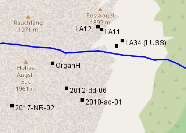
LUSS 1987, 1989
References
- 87.1514
- Austria Reconnaissance Expedition 1987, Lancaster University Speleological Society
- 90.1341
- Dead Mountains Expedition, Ian Rolland, Underground October 1989 pp 4-9 (Army Caving Association)
- 90.1342
- Dead Mountains Expedition 1989, Ian Rolland, Chelsea Speleological Society Newsletter 32(5) pp 56-9
Notes
Originally had this in the survex file:
;*fix raetsel.ent 38145.23 85275.55 1835