Surveys and Rigging Guides
Underground Description
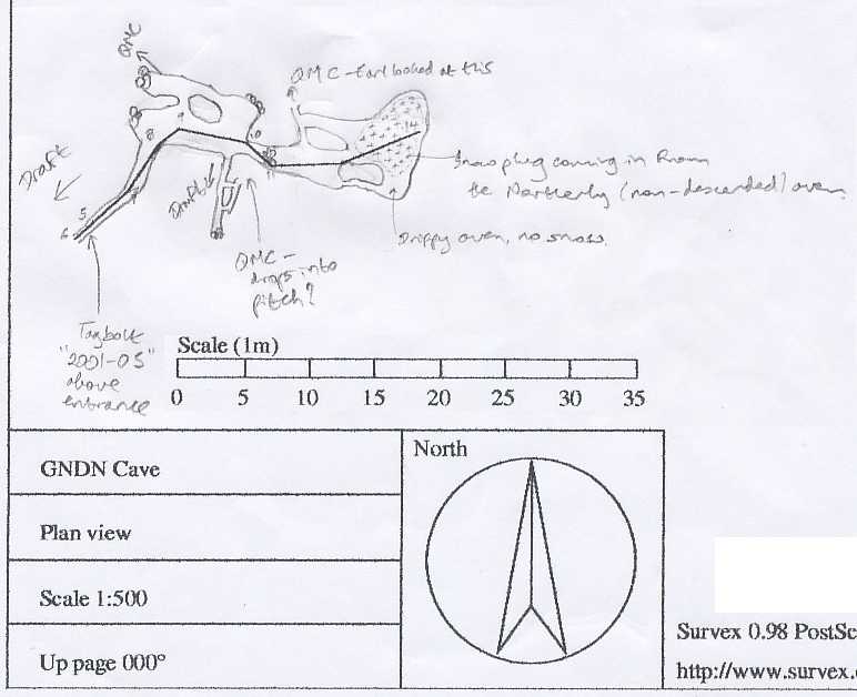
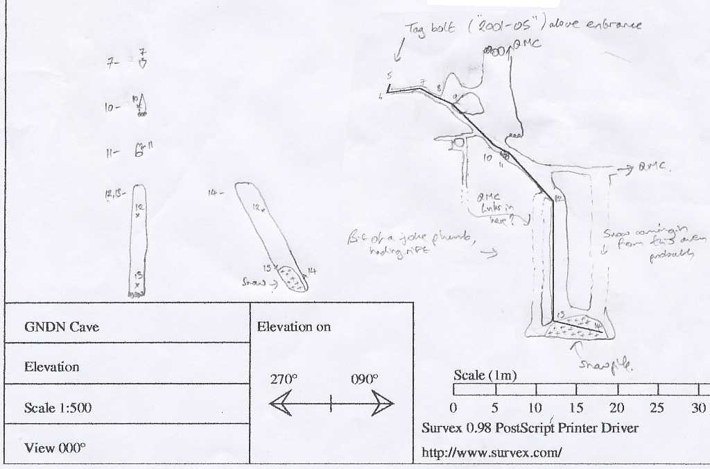
[Taken from 2001 log book] "It went in ~5m horizontally then into hading rift. I climbed down ~5m to the head of a pitch + various possibilities. Back out. Earl in to rig pitch whilst Mick + I surface surveyed from 204D tag bolt to new cave + put in a tag bolt above its entrance. Mick + I then continued the survey down to Earl. Pitch went down, still hading, to large snow + ice plug ... with no ways on + we seemed to have lost the draft. Surveyed to far side of chamber then back out. Earl derigged + Mick + I went into passage at top of pitch which had two LHS small leads off, both of which drop into steeply descending rift (the second one being too tight to go through). Mick dropped well down into the rift, which kept going, though without much draft, to a small way on which he reckoned would drop into the pitch. Its possible we did miss the way on in the cave as we seemed to have lost the draft down the pitch. Worth another look around probably."Equipment
Rope for 5m pitchExplorers
CUCC 2001 Earl, Becka, MickWallets: scanned survey notes
There are 1 wallets with data for this cave:2001#19