Entrances
-
Id letter: ''
2012-HW-01
Edit this entrance
- Marking
- Tag
- Marking Comment
- Tagged 2012-HW-01 on ESE side of shaft, in smooth slab.
- Findability
- Coordinates
- Location
- Near top of Niederes Augsteck, on north west side.
- Approach
- From 204 camp follow cairns towards Tunnockschacht. Before crossing final ridge on way to Tunnockschacht, head right up slope. Shaft is nearly at top of hill.
- Photo(s)
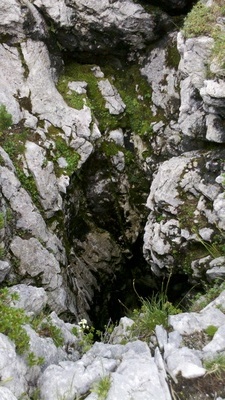
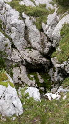
- Description
- Shattered near-vertical shaft near top of hill. Shaft approx 3 m diameter, approx 5 to 10 m deep. Pool of water in bottom of shaft. No discernable air flow. Shaft quite green and drippy.
- Explorers
- CUCC Expo Discovered 2012
- Tag Location
- 1623.p2012-hw-01 47.69442N 13.82265E (UTM33 411658, 5283008), 1902m (SRTM is +36 m, distance from reference: 18m)

