Entrances
-
Id letter: ''
2005-01
Edit this entrance
- Marking
- Paint
- Findability
- To be confirmed ...
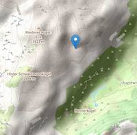
- Location
- Location in the survex file is given as Locn: Totes Gebirge, Austria - Loser/Augst-Eck Plateau (kataster group 1623) which does not match the GPS coordinates of 1623.p2005-01 which are beyond the Augst Eck ridge:
..which is accurately converted from WGS84 as documented in loser/fixedpoints/gps/gps05.svx
; Fixes from Wook's GPS, set to WGS84.
; Original data:
;       p2005-01        47 41 27.5 lat  13 49 55.0 long  1765m alt

*entrance p2005-01
*fix p2005-01 37485.85 83709.75 1717.24
But we have no records of Wookey going there, just a surface trip on 1st August, which is after the cave wa surveyed, whcih seems unlikely. On the other hand, 2005-01, -03 and -02 are all in a line on that side of the hill.There are no logbook trips with Mark and Emma in 2005, just the survexfile 2005-01.svx on 27th July 2005.
- Other Station
- 1623.p2005-01 47.6909841N 13.8319252E (UTM33 412348, 5282616), 1717m (SRTM is +70m, distance from reference: 17m)