1626 / 2018-pw-02

Surveys and Rigging Guides

sketches in Logbook 2018-07-24b and survey sketch in 2018-07-25a

Underground Description

2x1m shaft with 3s drop when rocks bounced off E wall. Shaft is at S end of a 30x40m depression with cliff tiers on N side. Photos on Philip's camera GPS. Waypoint on Philip's phone. Shaft is just N of a 10x5m knobble of bunde. 
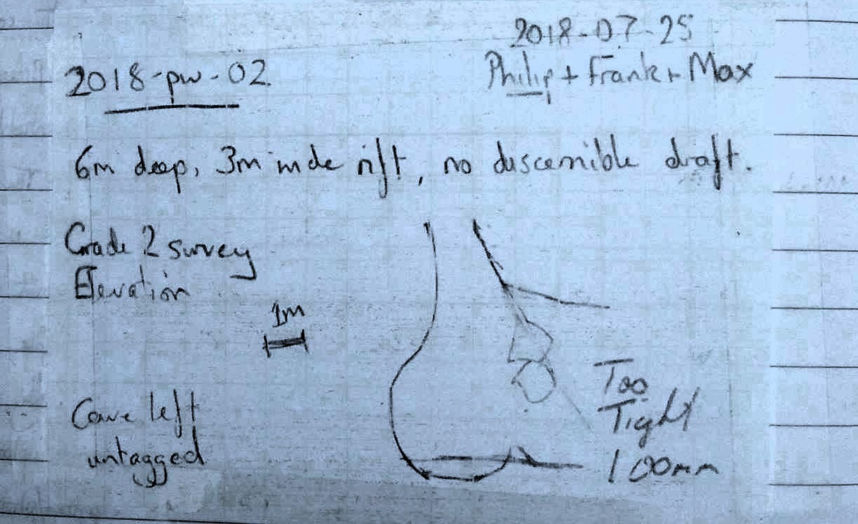
{ We came back on 2018-07-25 with Frank Tully and dropped this.See next page for updated notes and elevation. It craps out. Cave left untagged. Waypoint in prospecting GPX file. }

Explorers

Discovered 2018 Phil W and Typhon

References

2018#17 - scanned diagrams and notes

Entrances

  1. Id letter: '' Edit this entrance
    Marking
    Unmarked
    Findability
    Coordinates
    Location
    from waypoints_pwithnall-2018-07-24.gpx
    Date last visited
    2018-07-25
    Photo(s)
    Description
    Shaft is at S end of a 30x40m depression with cliff tiers on N side. Photos on Philip's camera GPS. Waypoint on Philip's phone. Shaft is just N of a 10x5m knobble of bunde.
    Tag Location
    1626.p2018-pw-02 47.69763N 13.80882E (UTM33 410626, 5283382), 1816m (SRTM is 0 m, distance from reference: 12m)

New Entrance

Survex File(s)

All survexfiles for this cave (if any)