1623 / 2018-MS-01 -

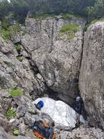
Underground Description

Rubble slope with snow plug down to a jammed boulder. Wriggle down next to it to a 45° ramp down. This levels off to a tight squeeze down to a small chamber. Around 30m long with no draft.

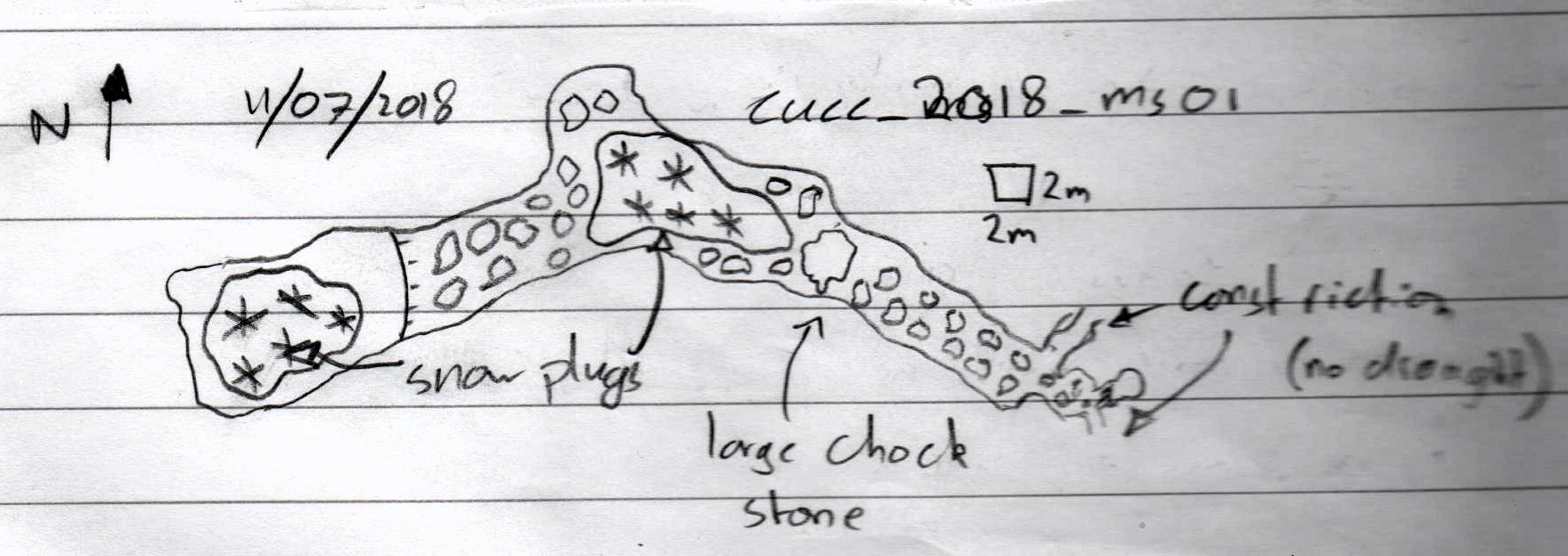
Logbook: 2018-07-11a

Sketch: see notes and photo on Becka's phone at 09:30 on 13/7/18 Notes: tag hammered into crack near to placed spit Photo: Becka's phone at 14:00

References

Becka's phone GPS 33+ 410730 5274320 Alt 1698m Accuracy 4m - but this location is actually the bier tent! We get the real location from a geolocated photo at 13:56.

Notes

2018-ms-01 Only records are in logbook. Becka, Tom, Mark Shinwell.

Entrances

  1. Id letter: '' 2018-MS-01 Edit this entrance
    Marking
    Tag
    Marking Comment
    tag hammered into crack near to placed spit
    Findability
    Coordinates
    Location
    Becka's phone GPS 33+ 410730 5274320 Alt 1698m Accuracy 4m
    Shinwell 2023-07-12: "this fix is miles off, so commenting out in gps/gps18.svx So this is effectly lost, though refindable, except that it is near 2018-ms-02, 03, 04" [in fact this is a fix of the bier tent, but with a different altitude] Entrance photo found, with GPS EXIF. So it is found.
    Date last visited
    2018-07-18
    Approach
    logbook entry 2018-07-18
    Photo(s)
    Description
    Lost - due to garbage GPS numbers
    Other Station
    1623.p2018-ms-01 47.6944423N 13.8097220E (UTM33 410688, 5283026), 1746m (SRTM is -3m, distance from reference: 23m)

New Entrance

Survex File(s)

All survexfiles for this cave (if any)