Underground Description
2018-07-18: Rock-filled rift ~1m high and wide goes 260 degrees magnetic into hillside (descending approx. 15 degrees). Hole in floor near ent. is a climbdown, then a 22cm squeeze (Radost did it) to where it continues - tight. No draft.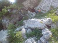
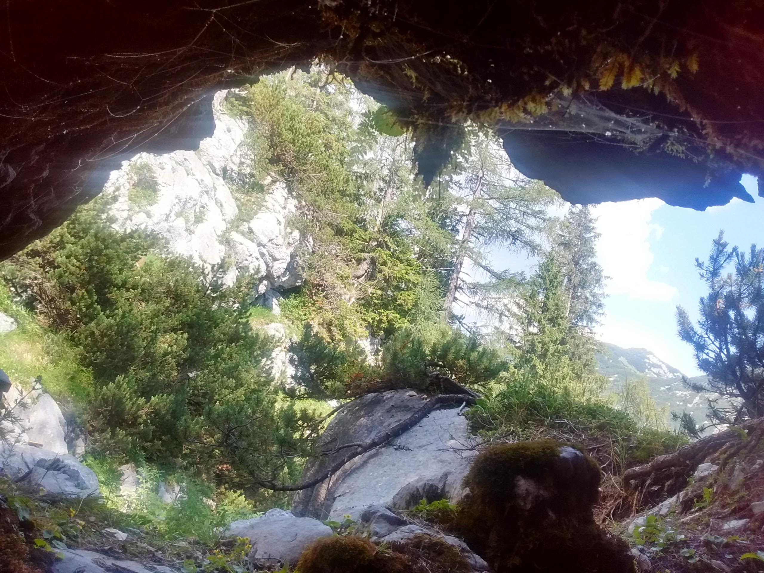
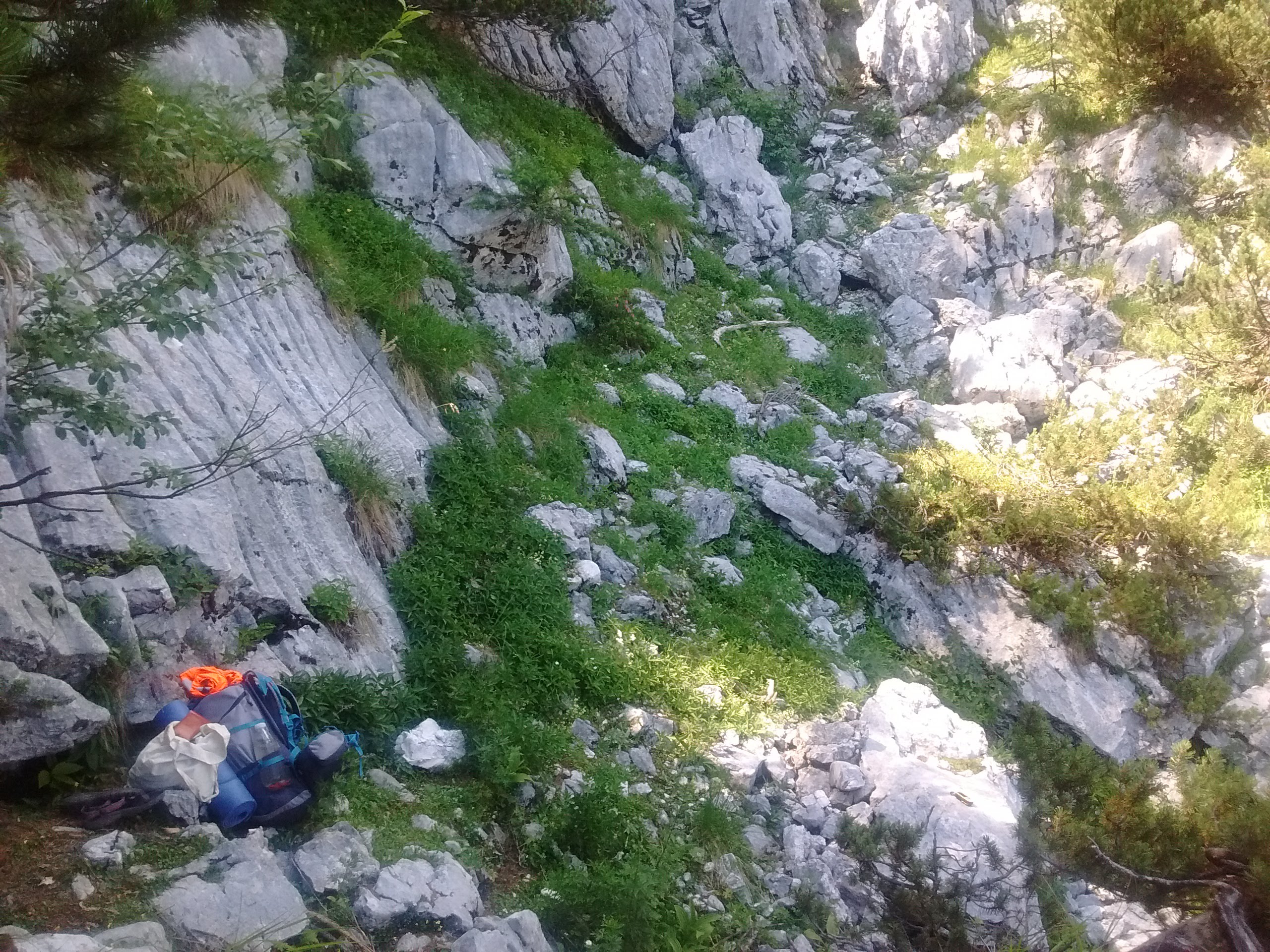
Going over the hole in the floor the more obvious route leads after 14m from ent.to a 2m climb down and a drafting flat-out hole leading to a vertical (upwards) solution (?) shaft filled with rocks. [Since the hillside is very steep here, this may be ~20m or more to the surface.] Could be dug, but ideally not from the bottom where Radost was. Whole cave drafts cold air out slightly - less in 2019 than 2018 possibly due to snow choke elsewhere. No snow visible anywhere near it. The roof of the rift is flat and slopes to the south, about 30 degrees from vertical. This is very similar to rifts in Schnellzughohle and Stellerweghohle nearby, but in this cave there are no flow scallops. Roof is solid rock and floor is blocks and rocks [and relic vadose features].
Explored properly by Radost & Philip in 2019. No survey.
Good sketch of how to find it in Logbook Wed 11 Jul 2007 when Mark Doherty and Anthony Day found it (again) while looking for 115. 114 is the "Small Cave Entrance (body-sized tube)".
Inserted here too:
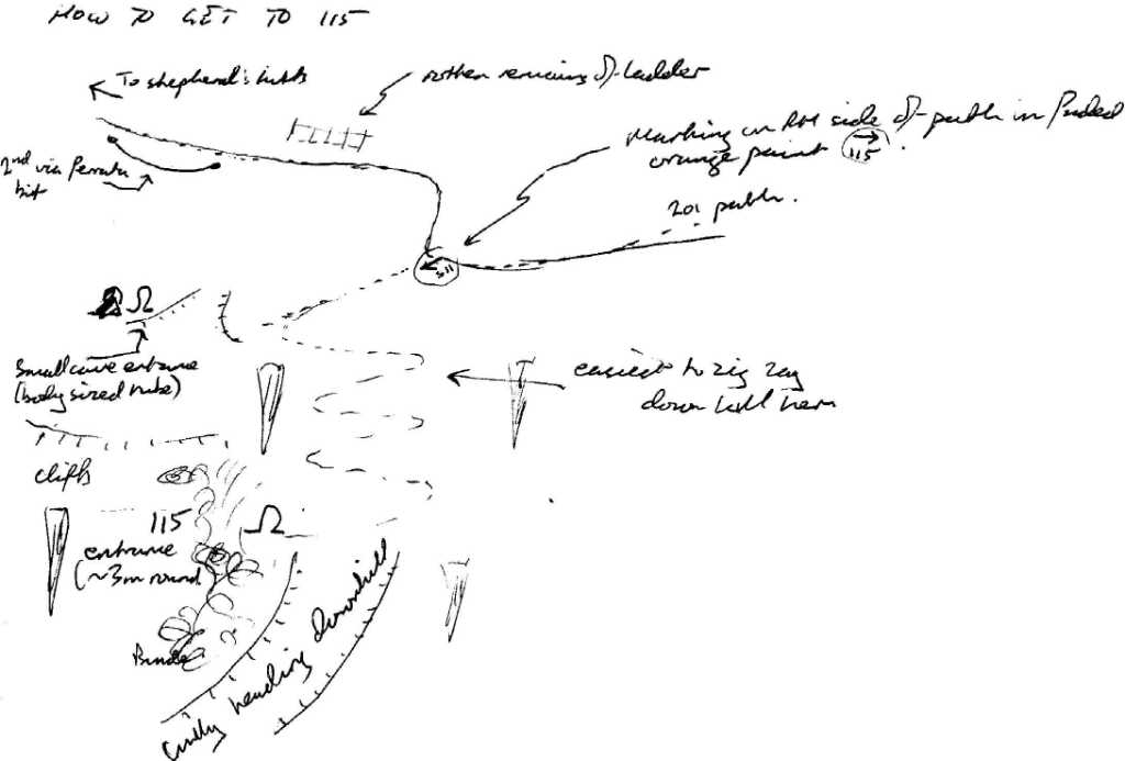
NOTE The shape, length and orientation of the cave is very suspiciously similar to surveyed 1623-228 "Kleine Schnellzughohle". And the entrance is very close (60m) to Schnellzughohle and does indeed look like a smaller version of Schnellzughohle. So is the survey location of 1623-228 in Egglgrube valley incorrect ?
Equipment
none. Chilly draft and scramble so shorts not advised.Explorers
CUCC 1980, 2007, 2019References
1980 logbook, 2007 logbook, 2018 & 2019 logbooks.Notes
Logbook: 2018-07-14Photos taken from turn-off point [from Stoger Weg]: "a barely discernable trod" to cave. This "trod" is much more overgrown than it was in 1982.
I have just (May 1990) found an old note book which says this was explored by John, Tony and Andy C, but gives no detail on where or what. There is a strong suspicion that the cave was one of the "promising leads" found on their trip to Wildenseealm. However, the only published account refers the reader to the 1980 log book. This latter is, unfortunately, missing.
This does not appear to be in the Austrians' Kataster.
AERW email 30 June 2020: The name Verlorenschacht was probably invented by me, and in the absence of the 1980 logbook, there is no real reason to believe it was a schacht, just something they thought worth a number in a year when we were making the effort to actually number stuff we found. It is _probably_ not (as you might hope) somewhere between 113 and 115, but it _might_ be ... There is something in that area that one steps over on a particular (probably obscure) route from one cave to another. I don't *think* it got a number but it *might* be 114. If that surmise is anywhere near, then it is between the Stogerweg and 113, rather than close to 115.
> But it is definitely not a "Schacht": more a horizontal scramble with a > couple of pits. [Philip] That doesn't sound like the thing in the 113 area I'm thinking of - that was at least a bit of a climb down at the entrance (enough not to venture in without at least a handline). Of course, if it was something on the Wildenseealm walk, then it is nowhere near 113/41/115.
The missing 1980 logbook really is critical to this one.
Philip Sargent email 1 July 2020 to Wookey:
> According to AERW it might or might not be the same cave, or be might > be remembering something else; but it is arguably in the right place > as at least two groups have found it while looking for 115 coming from > the path - and 113 is on the other (upper) side of the path - so it is > topologically between 113 and 115 even if not geometrically between 113 and 115. > > I say let's go for it and rub out the uncertainty. > Which means I had better write up a sketch survey for all 15m of it.
I've not followed the whole thread/saga, but at this stage I think this sounds reasonable. Almost anything would be an improvment and so long as we're reasonably sure that the original 114 is not marked as such in a way that might one day be noticed (and it seems unlikely that the 1980 logbook will surface at this point) any reasonable effort to get a cave in about the right place should suffice.
Wookey