Surveys and Rigging Guides
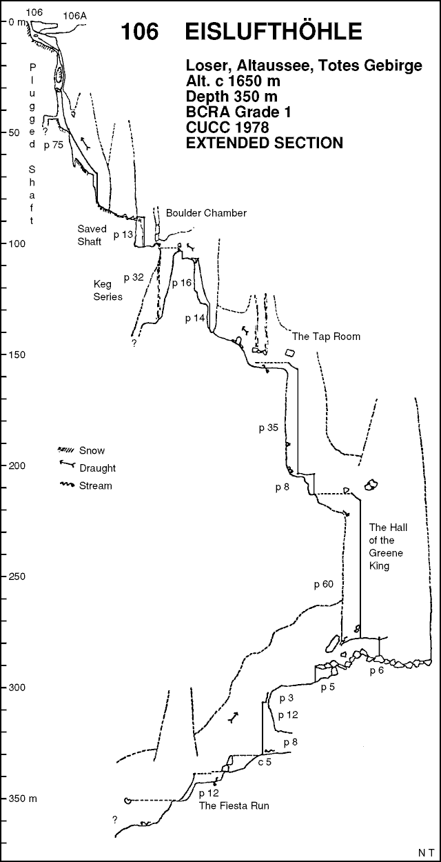
The lower parts of the 1970s surveys are based on measurement of rope lengths and thus probably best categorised as Grade 2. The 2004 resurveyed depth for the taproom agrees closely with the 1970s surveys:
Underground Description
Explorers
CUCC 1977-79,2004-2006
References
The exploration is written up in many places:
- Cambridge Underground 1978
- Belfry Bulletin 354, Nick Thorne
- Cambridge Underground 1979
- BCRA Caves & Caving 2, Andy Waddington
- Northern Pennine Club Journal vol 3 no. 2, 1979, Andy Waddington, Simon Farrow
- Descent 40 (Jan/Feb 1979), Nick Thorne
- Belfry Bulletin 366 (Oct 1978), Nick Thorne
- Cambridge Underground 1980
- Descent 44, Nick Thorne
- Belfry Bulletin 378, Nick Thorne
- BCRA Caves & Caving 8, Andy Waddington
- Logbook accounts
- Trip index
- Speleo Krakow 1/2 Dec 1980, Andy Waddington
This last item, the only complete write up of 1977-79, appeared in Polish translation, and is published in the English original for the first time here.
Wallets: scanned survey notes
There are
32 wallets with data for this cave:
2004#01
2004#03
2004#04
2004#05
2004#07
2004#17
2004#18
2004#19
2004#20
2004#21
2004#22
2004#23
2004#24
2004#37
2004#38
2005#06
2005#08
2005#13
2005#31
2005#32
2005#33
2006#13
2006#14
2006#30
2006#32
2006#34
2006#35
2007#33
2007#94
2007#95
2016#00
2016#56
Notes
Data for the sections covered so far by the resurvey project begun in 2004 can be downloaded as a
.3d file.