1623 / 91 Bräu Schacht 91 1/S +

Surveys and Rigging Guides

1996 survey

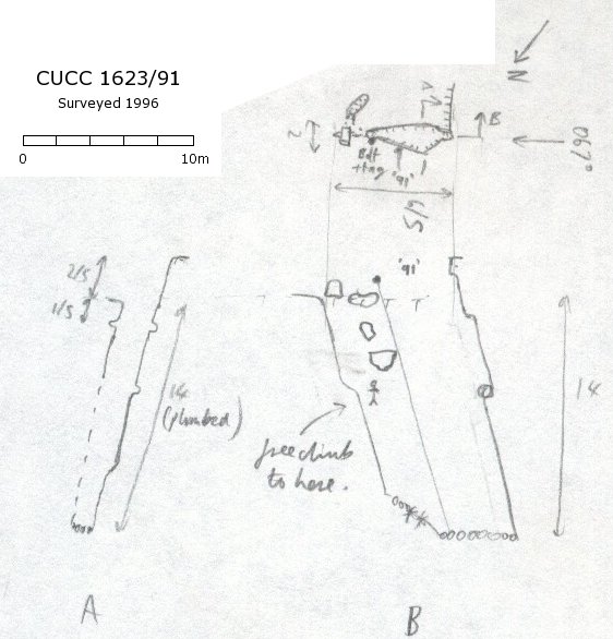
Grade 2 (at a guess), drawn up in loose leaves in front of 1996-9 NotKH book

Underground Description

A snow-fed rift in open karren on a fault/joint aligned on 67°. Choked at -20m (or plumb of -14m in 1996 to tiny snow plug).

Explorers

CUCC 1977 - Team Enthusiast.

Entrances

  1. Id letter: '' Edit this entrance
    Marking
    Tag
    Marking Comment
    number in red (1977) on small scarp facing south, 1998 tag "1623 91 CUCC 1977"

    this used to have fixed point 1623.gps00.91 to locate it, but this seems to have been removed from the fixedpts list.

    Findability
    Coordinates
    Location
    Plateau - below Bräuning Scharte. GPS: UTM 33T 0410171 5280908; UTM 33T 0410155 5280976; UTM 33T 0410177 5280894
    Approach
    From Schwarzmoossattel, follow cairned path below the Bräuning Wall, past Top Camp (1988 on). Where this path meets the scree/snow slope from the wall, it turns right, out onto the plateau (this is the main path to Gschwandt-Alm, in frequent use).

    100m from the right turn is a snow field on the right, with the sound of falling water at its lower edge. This is the entrance to 91. The bolt is at the NE end of the rift.

    Photo(s)

    Entrance 91 looking towards entrance 93 (77k JPEG)
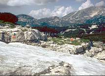
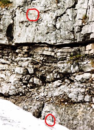
    Entrance 91 looking north towards 93 and SchönbergCloseup showing location of tag and paint markings (original here)

    (Photos © Andy Waddington 1990 and Olly Betts 1999)

    Tag Location
    1623.p91 47.67999N 13.80242E (UTM33 410115, 5281429), 1640m (SRTM is +64 m, distance from reference: 33m)
    Bearings
    Schönberg 347°, HSK 054°, VSK (nipple) 108°, Bräuning Nase 150°, Bräuning Wall pt. 1828 210°, Bräuning Wall pt. 1835 224°

New Entrance

Survex File(s)

All survexfiles for this cave (if any)
Primary survex file for this cave
Download .3d file 1623-91.3d
cave survex path '1623/91/'