Entrances
-
Id letter: 'a'
Edit this entrance
- Marking
- Tag
- Marking Comment
- Tag 21/7/2004
- Findability
- Coordinates
- Location
- Other station p2004-10_2 is from re-visit in 2013 using different gps (2013#23). But it works out as 185m due north of p2004-10. Figures a bitscribbled on raw source
- Approach
- From 204 bivvy over col then down + west following line of large shafts / collapses.
- Photo(s)

- Description
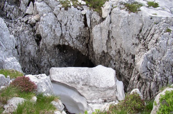
- Entrance shaft with snow plug, pitch visible beyond
- Tag Location
- 1623.gps04.p2004-10 47.69400N 13.81782E (UTM33 411295, 5282967), 1800m (SRTM is +15 m, distance from reference: 27m)
- Bearings
- 215 deg to Zinken, 309 deg to Griess Kogel. (I suspect there is an error here, as this would be almost right at the summit of the Griess Kogel -DL.)
- Other Station
- 1623.gps04.p2004-10_2 47.6956588N 13.8177152E (UTM33 411290, 5283152), 1805m (SRTM is 0m, distance from reference: 28m)