Surveys and Rigging Guides
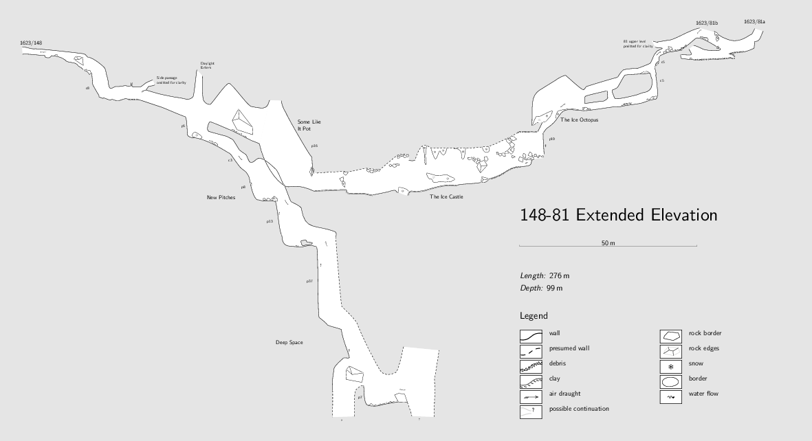
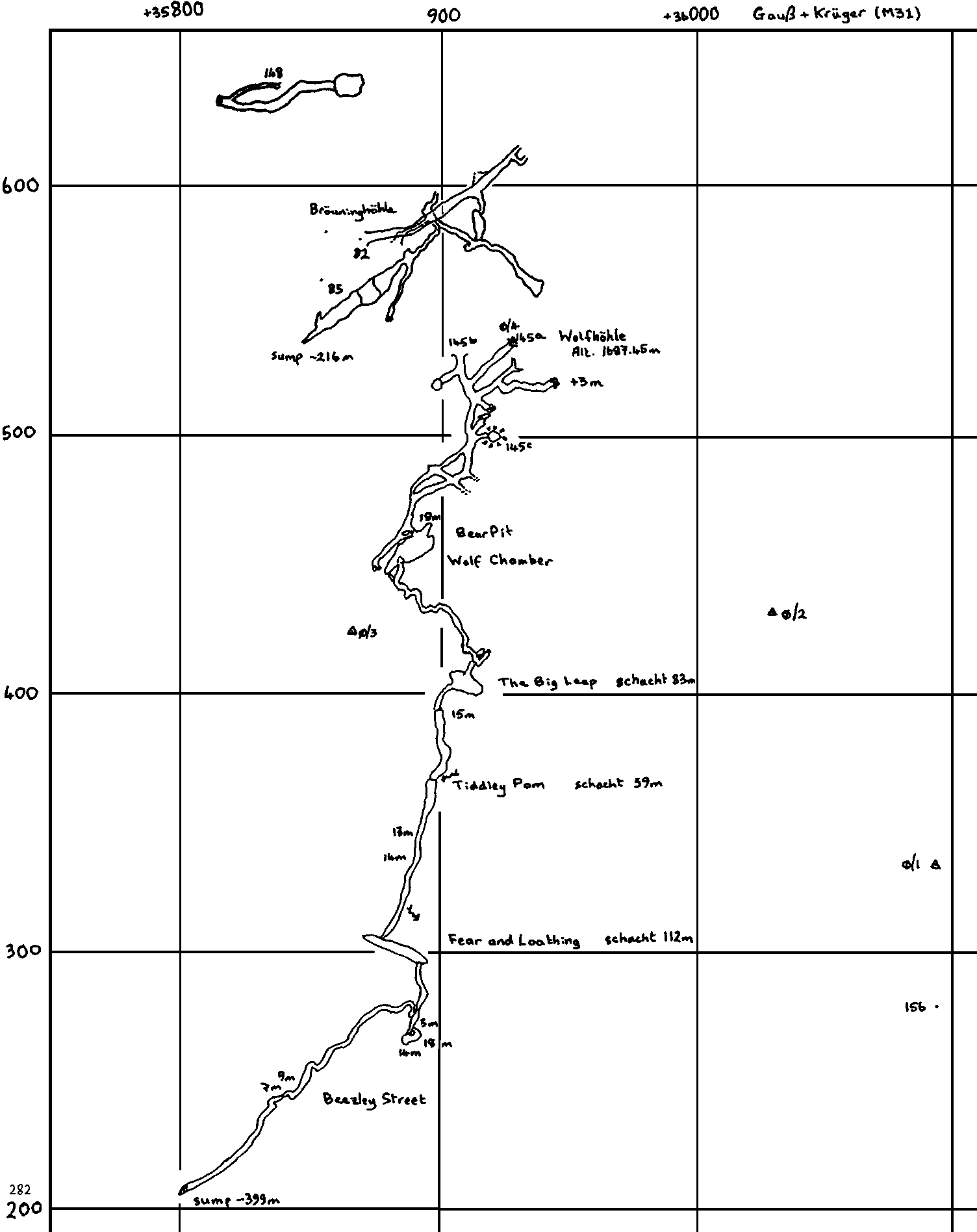
Extended Elevation of 148 and 81 (2012):
Plan of 148 (2012):
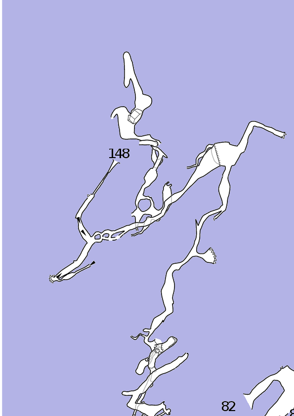
Area plan, showing 81, 82, 107, 148, 1987-02, 2006-06 and 2006-76 (2012):

There is also a 1980s survey area plan, drawn at 1:2000, showing 145, 82 and 148 on Gauß and Krüger coordinates.
Underground Description
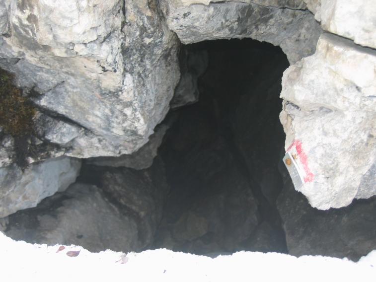
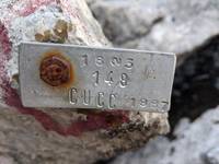
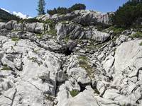
Not really pushed in 1984, since discovered right at the end, but relocated in 1987: horizontal tube entrance about 1m in diameter. An awkward crawl over boulders for 10m leads to a squeeze down behind a boulder with light entering ahead. Short freeclimb reaches a phreatic tube of about 3m diameter. To the right silts up in boulders while to the left descends gently over snow and big rocks to reach a sizeable chamber and pitch of about 20m. Avoiding the pitch, a route down through boulders for 3m reaches a very unstable boulder slope, which is crossed to reach another 3m pitch to a rift with a further pitch on the left. To the right, the roof lowers over large boulders, and a small ice chamber is reached with a frozen stream. A narrow section leads down to a rift of 5m down to an earthy passage.
Back at the boulder slope (I think), the 20m pitch can again be attained and from here is 15m to the floor of a 20m high chamber with three ways on. Facing away from pitch, righthand rift leads to a flat-out crawl over ice. This passes remarkable ice formations to emerge at The Ice Castle, a chamber with a large ice-stalagmite formation. The route terminates in a steep ice slope at the far side of the chamber.
Way directly ahead from pitch is a 3m climb into a large phreatic tube round a 90° bend to a solid wall of boulders. Ways into the choke proved very loose and tight, but a continuing rift/chamber could be seen through a tiny but strongly draughting hole.
Third way on from pitch ascends steeply and becomes tight, with a jammed boulder now in the way. Route ends at a steep ice-climb for which no equipment was available.
Explorers
CUCC 1984, 1987Wallets: scanned survey notes
There are 6 wallets with data for this cave:2007#04 2007#30 2007#35 2007#37 2007#93 2012#48


